


Deskripsi Planit: Photo Planner
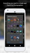
In this free app, the Ephemeris feature is provided as in-app purchase which will be the same as the PlanIt! Pro after the purchase. Some screenshots listed here have Ephemeris features enabled. The free version with the Ephemeris features can actually do a lot of things than you thought. It is a plan/marker file reader, a focal length estimator on the map, a DOF calculator, a panorama calculator, a map with marker features. The Ephemeris features are all inter-connected so it is hard for us to provide some ephemeris features in the free version and ask you to pay for the rest. Although we didn't provide a trial, please feel free to purchase to try it. We can refund you at any time if you don't like it.
The latest video tutorials are available at
https://www.youtube.com/watch?v=JFpSi1u0-is&list=PLTmlTTxPbBbcn1Fd1NRWTOczTY1RYEug4
===
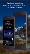
This is a special call to landscape photographers, travel photographers, nature photographers and those who are interested in night photography, city photography, time-lapse, star-trails, milky way or astrophotography: look no more, this is the ultimate app for you - Planit. It only costs you a cup of Frappuccino but will save you tons of time and effort and a lot of gas money. Most importantly, it will make you enjoy landscape photography even more.
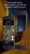
Ansel Adams dedicates the beginning of his first book "Taos Pueblo" to visualization. He introduced the idea of "previsualization", which involved the photographer imagining what he wanted his final print to look like before he even took the shot. Of course, there are many great photos which were taken impromptu. However, for landscape photographers, being able to previsualize the scene before going there will greatly reduce the chance of being caught unprepared and will greatly increase the chance of getting better shots.
Photographers use various tools to help them pre-visualizing the scene. Nowadays, many of those tools are phone apps. PlanIt! is an all-in-one solution that is designed to leverage the map and simulated viewfinder technologies to provide the necessary tools for photographers to pre-visualize the scene in combination with the ground subjects and the celestial objects such as the Sun, the Moon, Stars, Star-trails and Milky Way.
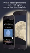
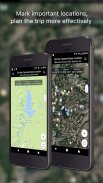
In a single app, we packed it with features - from location scouting such as GPS coordinates, elevations, distance, elevation gain, clear view, focal length, depth of field (DoF), hyperfocal distance and panorama, to the Ephemeris features such as the sunrise, sunset, moonrise, moonset time and direction, twilight time, special hours of the day, sun/moon finder, major stars, constellations, nebulae azimuth and elevation angle, star trail planning, time-lapse calculation and simulation, milky way searching, exposure/ND filter calculator, light meter, bulb timer, rainbow position prediction, tide search etc. All the information are either represented on the map as an overlay or visually presented in a simulated viewfinder (VR, picture, or street view), just like you look through your camera's viewfinder. Whatever you want for your landscape photography, it is there in the Planlt!.
Dalam aplikasi gratis ini, fitur Ephemeris disediakan sebagai pembelian dalam aplikasi yang akan sama dengan PlanIt! Pro setelah pembelian. Beberapa tangkapan layar yang tercantum di sini mengaktifkan fitur Ephemeris. Versi gratis dengan fitur Ephemeris sebenarnya dapat melakukan banyak hal daripada yang Anda pikirkan. Ini adalah file plan / marker reader, penaksir panjang fokus pada peta, kalkulator DOF, kalkulator panorama, peta dengan fitur marker. Fitur Ephemeris semuanya saling terhubung sehingga sulit bagi kami untuk menyediakan beberapa fitur ephemeris dalam versi gratis dan meminta Anda untuk membayar sisanya. Meskipun kami tidak memberikan uji coba, jangan ragu untuk membeli untuk mencobanya. Kami dapat mengembalikan Anda kapan saja jika Anda tidak menyukainya.
Tutorial video terbaru tersedia di
https://www.youtube.com/watch?v=JFpSi1u0-is&list=PLTmlTTxxbbbcn1Fd1NRWTOczTY1RYEug4
===
Ini adalah panggilan khusus untuk fotografer lanskap, fotografer perjalanan, fotografer alam, dan mereka yang tertarik pada fotografi malam, fotografi kota, selang waktu, jejak bintang, bima sakti atau astrofotografi: tidak terlihat lagi, ini adalah aplikasi terbaik untuk Anda - Planit. Ini hanya menghabiskan secangkir Frappuccino, tetapi akan menghemat banyak waktu dan tenaga dan banyak uang bensin. Yang paling penting, itu akan membuat Anda lebih menikmati fotografi lanskap.
Ansel Adams mendedikasikan awal buku pertamanya "Taos Pueblo" untuk visualisasi. Dia memperkenalkan ide "previsualisasi", yang melibatkan fotografer membayangkan bagaimana dia ingin cetakan terakhir terlihat sebelum dia mengambil gambar. Tentu saja, ada banyak foto hebat yang diambil secara dadakan. Namun, untuk fotografer lanskap, dapat melakukan previsualisasi pemandangan sebelum pergi ke sana akan sangat mengurangi kemungkinan tertangkap tidak siap dan akan sangat meningkatkan kemungkinan mendapatkan bidikan yang lebih baik.
Fotografer menggunakan berbagai alat untuk membantu mereka melakukan pra-visualisasi pemandangan. Saat ini, banyak dari alat itu adalah aplikasi telepon. PlanIt! adalah solusi menyeluruh yang dirancang untuk memanfaatkan teknologi peta dan simulasi jendela bidik untuk menyediakan alat yang diperlukan bagi fotografer untuk melakukan pra-visualisasi pemandangan dalam kombinasi dengan subjek tanah dan objek langit seperti Matahari, Bulan, Bintang, Jejak Bintang, dan Bima Sakti.
Dalam satu aplikasi, kami mengemasnya dengan fitur - dari pencarian lokasi seperti koordinat GPS, ketinggian, jarak, penguatan ketinggian, tampilan yang jelas, panjang fokus, kedalaman bidang (DoF), jarak hyperfocal dan panorama, hingga fitur Ephemeris seperti fitur matahari terbit, matahari terbenam, bulan terbit, waktu dan arah bulan, waktu senja, jam khusus hari itu, pencari matahari / bulan, bintang-bintang utama, rasi bintang, nebula azimuth dan sudut ketinggian, perencanaan jejak bintang, perhitungan dan simulasi selang waktu, bimasakti pencarian, paparan / filter ND kalkulator, pengukur cahaya, penghitung waktu bulb, prediksi posisi pelangi, pencarian pasut dll. Semua informasi diwakili di peta sebagai overlay atau disajikan secara visual dalam jendela bidik yang disimulasikan (VR, gambar, atau tampilan jalan) , sama seperti Anda melihat melalui jendela bidik kamera Anda. Apa pun yang Anda inginkan untuk fotografi lanskap Anda, ada di Planlt !.
Planit: Photo Planner - Versi 10.5.1
(20-02-2024)
Planit: Photo Planner - Informasi APK
Versi APK: 10.5.1Paket: com.yingwen.photographertoolsAplikasi pada kategori yang sama
Anda juga mungkin suka...


